|
||
|
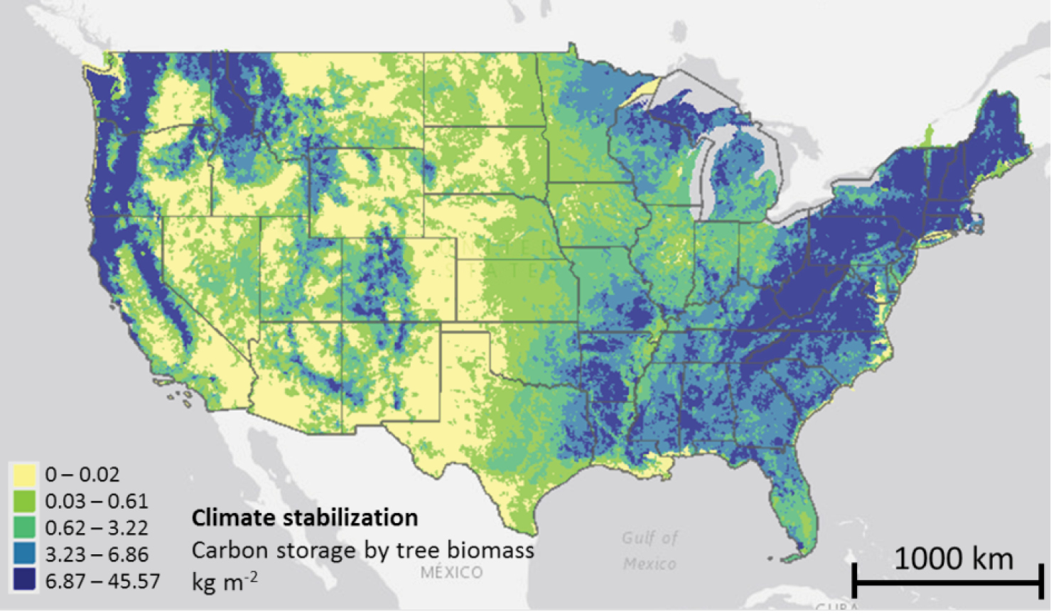
This map shows the kind of data layers that are available in EnviroAtlas. For one of the indicators in the climate stabilisation category, this map shows the amount of carbon stored in the above-ground tree biomass. Like most of the national maps in EnviroAtlas, the data are summarised by medium sized watershed drainage basins known as 12-digit hydrological unit codes (HUCS). There are approximately 85,000 of these HUCS in the conterminous US, with each being approximately 104 km?. Users of EnviroAtlas can also overlay demographic maps to gain the perspective of proximity and population dynamics of beneficiaries. |