|
||
|
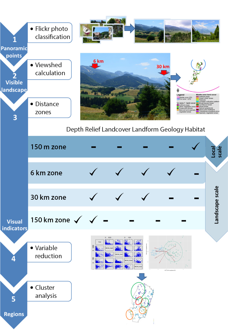
Methodological framework for visual landscape assessment. The visible area (viewshed) was calculated for each location of photo representing panoramic views. The four distance zones were set to respect the degrading visual properties with increasing distance from the viewpoint. |