|
||
|
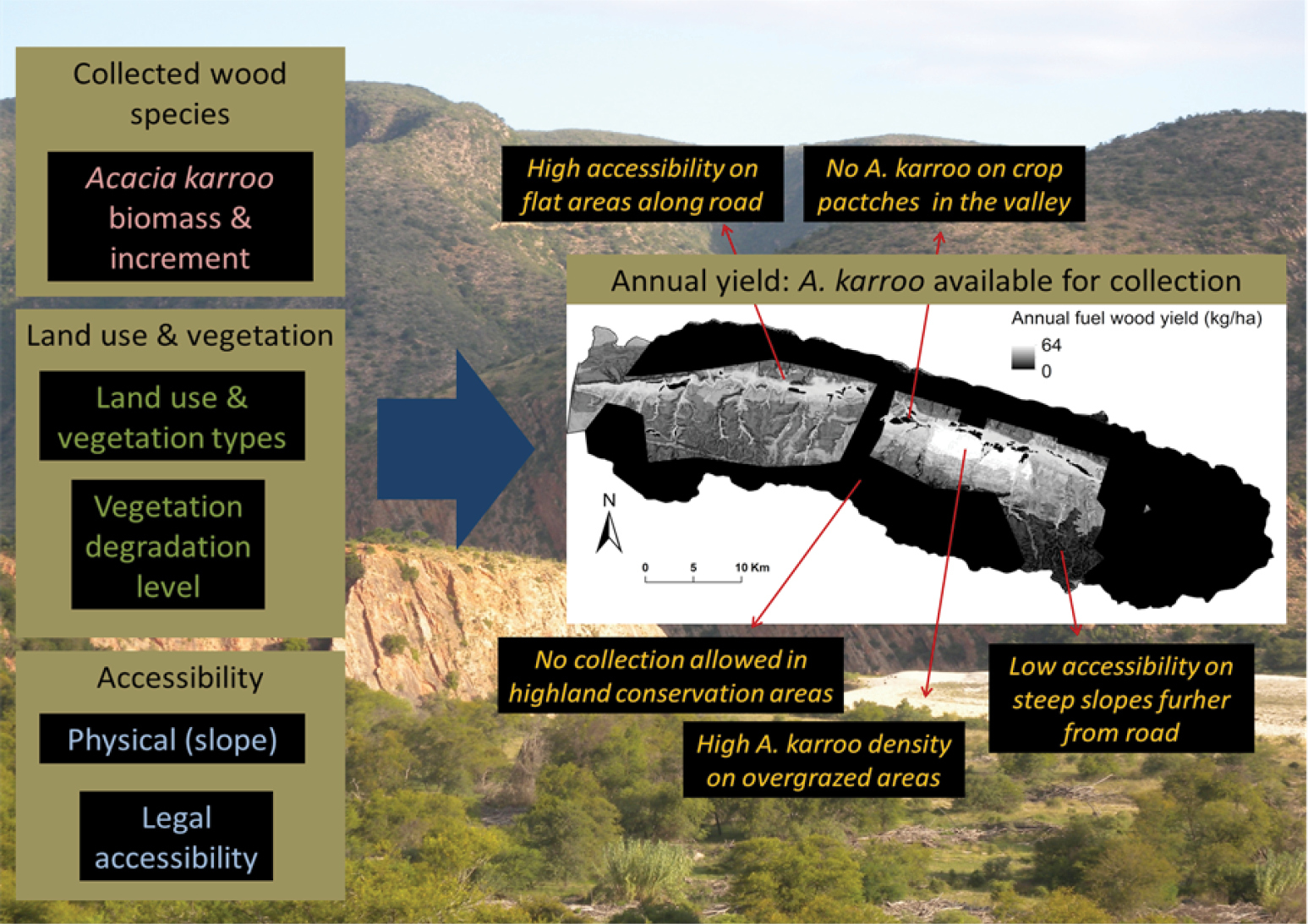
Mapping fuel wood supply in the Baviaanskloof Catchment in South Africa using local data consultations. Combining multiple indicators (left) results in a fuel wood yield map (right). Several data sets were combined to show the spatially diverse supply of fuel wood (including topography, accessibility and also conservation areas), (Source: Petz et al. 2014). |