|
||
|
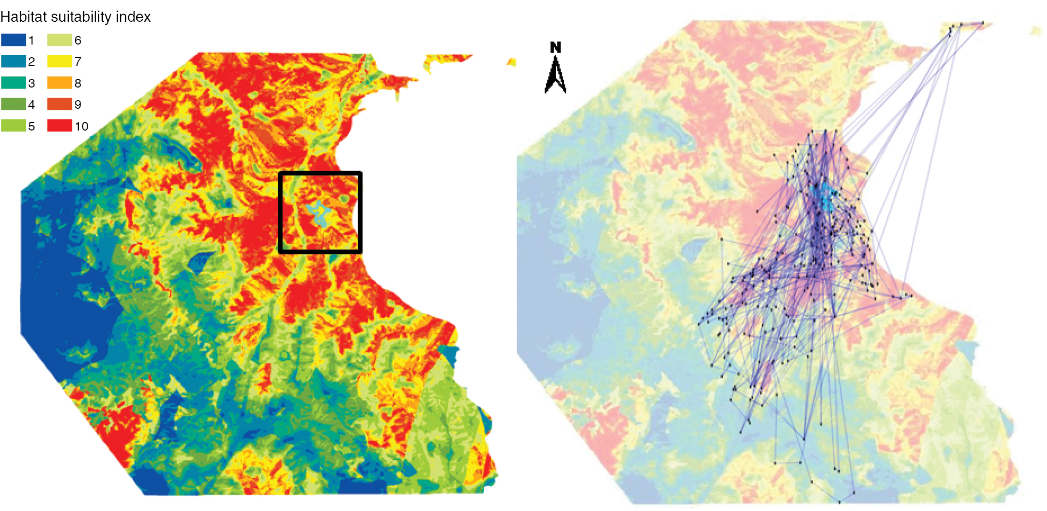
Habitat suitability map of a male brown bear produced by using telemetry data of 8 individuals, collected in the north-eastern part of the Pindos mountain range, Western Greece, over a twenty-month period (April 2007 – December 2008) provided by CALLISTO-Greece. Habitat suitability index is classified in ten classes. Habitat maps were produced by using data on 7 bears while withholding one bear to be used for the development of graph models. Dots and lines represent the centroids of habitat patches and the movement among patches for the studied animal, respectively. |