|
||
|
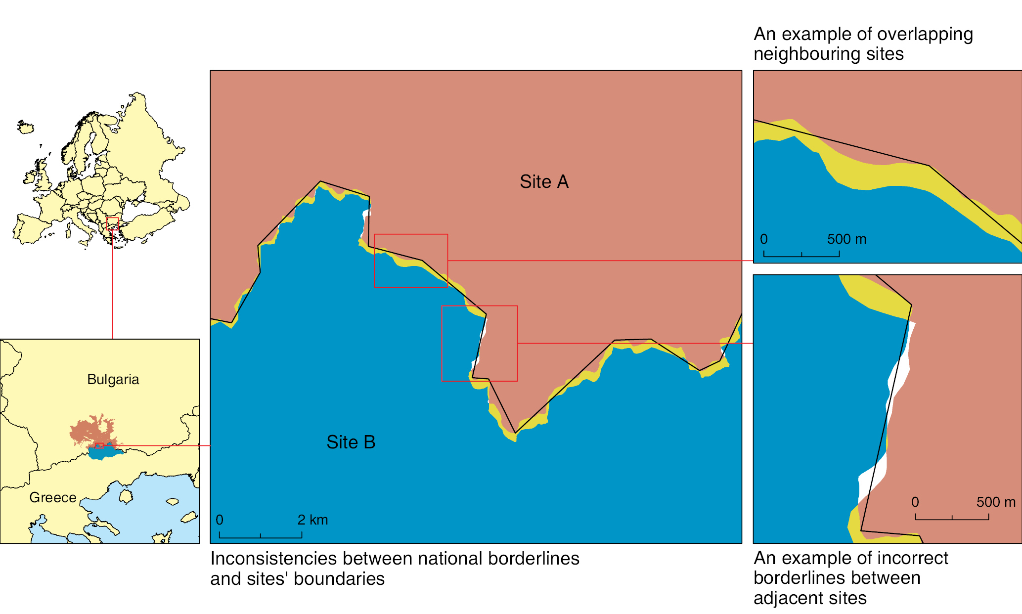
Typical example for technical incoherencies in GIS: digitizing problems on common borderlines. For this map we used Natura 2000 dataset (source: http://www.eea.europa.eu/data-and-maps/data/natura-4) and NUTS database (source: http://epp.eurostat.ec.europa.eu/portal/page/portal/gisco_Geographical_information_maps/popups/references/administrative_units_statistical_units_1). |