|
||
|
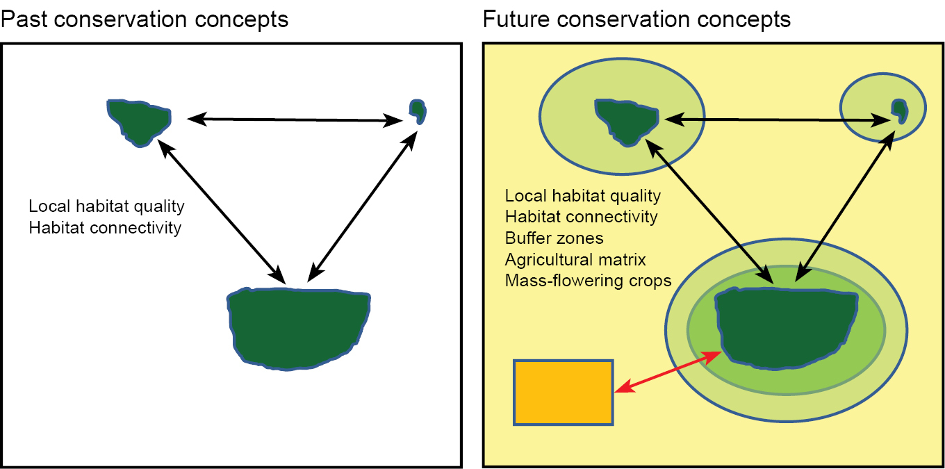
Past and current concepts to manage conservation areas at multiple spatial scales. Green irregular shapes represent conservation areas (dark green – high habitat quality, pale green – low habitat quality. Circles indicate buffer zones with extensified management schemes. Yellow illustrates the agricultural matrix and orange mass-flowering crops. Arrows illustrate the flow of resources and organisms between habitat types. |